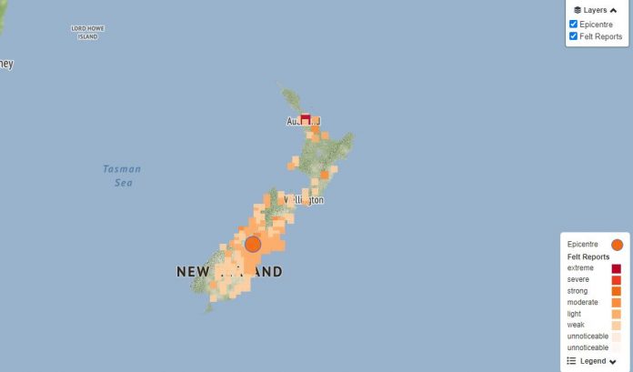
The magnitude 6 earthquake that rocked Mid Canterbury yesterday was on an unknown faultline near Mt Somers.
There have been at least 50 aftershocks following the 9.14am quake, which was the strongest earthquake to hit New Zealand this year.
It was centred between Ashburton and Timaru districts, in the Rangitata Gorge, where two identified active faults meet – the Ben McLeod Fault and the Lake Heron Fault.
GeoNet said on its website the nearby large faults were estimated, from landform evidence, to have each ruptured several times in the recent geological past (within the last 18,000 years), but not since European records began.
“The epicenter of the earthquake lies south-east of more active regions, and 70km from the Alpine Fault.”
David Barrell of GNS Science said the earthquake occurring was not surprising, considering the area of its epicentre.
‘‘It’s not a surprise, it’s in an area where there are several recognised active faults,” Barrell said.
Mt Somers Springburn School principal Morgan Platt said some items fell from shelves in the school’s resource room, as children and teachers got under desks, when the earthquake struck.
Looking at the location of the epicentre on GeoNet, he estimated it was about 15 kilometres away from the school.
The quake had been scary for some teachers, as it took them back to the times of the Canterbury Earthquakes in 2010 and 2011, and for some of the younger children in the school.
‘‘For a couple of our five-year-olds, they were shaken up, had to hug their sibling to calm down a wee bit,’’ Platt said.
For himself, he had been driving to school at the time and had suspected there was an earthquake as his car rocked.
Meanwhile, the district council is advising building owners who see visual damage to reach out to an engineer for assistance.


